
ProductPins and boundaries
Draw, walk or import field boundaries
PropelMapper gives you three ways to put a field boundary on the map: draw it with your finger, walk it with the phone, or import the file you already have.

Mapping a new client’s farm
The question we hear most from teams setting up is some version of: will it find my fields? It will not, and we would rather say so on this page than have you discover it on day two. PropelMapper does not guess where a field begins and ends. Somebody who knows the farm decides.
That sounds like work, and for one afternoon it is. A farm with an FSA map and a fence line you trust takes a few minutes for each field to draw on satellite imagery. A field with a creek on one side and a neighbor's ground on the other is faster to walk: start the boundary, walk or drive the edge, close it. A client whose previous provider sent you a shapefile takes one upload.
We think walking a boundary once beats fixing a wrong one forever. An automatic outline that cuts through the waterway puts your soil map, your crop history and your acres wrong on every report for that field, quietly, every season.
Field record: what you said and what the report says
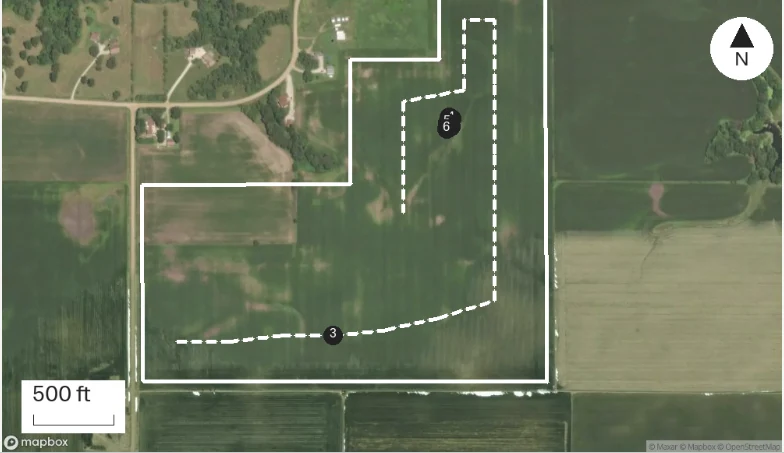
This field was walked once in the spring. Every visit since has pinned its captures inside that outline.
“Starting the walk at the northeast corner by 230th. The boundary jogs in around the farmstead, then straight down to the south fence.”
Prairie Agronomy
Field record
At a glance
Field boundary walked on site, 100.7 acres. The outline follows the farmstead jog on the north side and the south fence line.
Observations
Field boundary walked on site, 100.7 acres. The outline follows the farmstead jog on the north side and the south fence line.
After your review
Example account: Prairie Agronomy
Ways to add a field boundary
Draw on the phone when you can see the edges from above. Trace the edges on satellite imagery and save. The field's acres show on the map once it is saved, which is a quick check against the number the grower gave you.
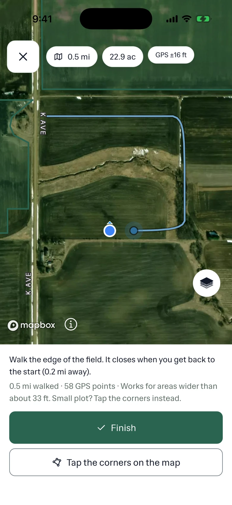
Walk when the edge is not visible from above, or when the boundary is a line you agreed on the ground: an easement corner, a pasture split, a trial strip. Start a walked boundary and follow the edge on foot or in the truck. The phone records the track as you go, with or without signal, and closes it into a field when you finish.
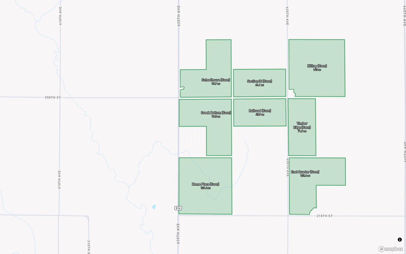
Import in the web app when the boundaries already exist somewhere else. PropelMapper takes CSV, KML, KMZ, GeoJSON and zipped shapefiles up to 20 MB.
Capture pins inside a field
A boundary says where the field is. A pin says where you were in it. Every capture in a visit, voice note, photo, clip, typed note or reading, is saved with the GPS point where you took it and drawn as a pin on the visit map, colored by kind.
That is what makes a report checkable. When the grower asks which corner had the ponding, the answer is a pin by the tile outlet, not a sentence that says northeast-ish. When you come back later, you can stand on the same pin and take the same photo.
Places that do not need a boundary can be a single point: a barn, a pivot, a greenhouse range, a client's yard. A point still collects visits and pins the same way.
In the app
Example account: Prairie Agronomy
Questions about pins and boundaries
Will PropelMapper draw my field boundaries for me?
No. You draw them, walk them or import them. We do not outline fields automatically, because a boundary that is slightly wrong makes every layer and every acre figure on that field slightly wrong.
Which boundary files can I import?
CSV, KML, KMZ, GeoJSON and zipped shapefiles, up to 20 MB per file, in the web app.
Can I walk a boundary without cell service?
Yes. The phone records the walk offline and uploads the finished boundary when it reconnects.
Who it’s for
Farm managers and land companies setting up a new client, easement monitors who need the corner that was agreed on the ground, soil sampling crews who return to the same points, and appraisers who need acres they can defend.