

ProductVisit density
Heat map of where your team has been
The visit heat layer in PropelMapper paints every capture your team recorded onto the map, so the places that get all the attention glow and the ones nobody has walked in months stay pale.

Finding places nobody has visited
Every team has one. It is not a problem farm, which is exactly the problem. The owner never calls, the fields are fine, and it sits between two busier accounts so nobody plans a day around it. By the time someone notices, it has been most of a season.
Turn on Visit heat in the map's layers and the pattern is obvious in a second. Schoolhouse, Creek Bottom and Home Place glow because that is where the team records the most. A couple of fields barely show at all. Nobody has to run a report or confess anything.
We think that is the right use of a heat map on a field team: it shows where the next visit is overdue, not who is slacking. Combine it with the last-visit colors on each field and the list of places that need a visit, and the answer to what next is usually on one screen.
Follow-up: what you said and what the report says
A manager looking at visit heat on a Monday, then talking to the advisor who covers the pale corner.
“Section 30 hasn't had anyone in it since August. Priya, can you put it on Thursday with Timber Edge, just a quick walk.”
Follow-up - Section 30
At a glance
No visit recorded since August. A walk is scheduled for Thursday alongside Timber Edge.
Observations
No visit recorded since August. A walk is scheduled for Thursday alongside Timber Edge.
After your review
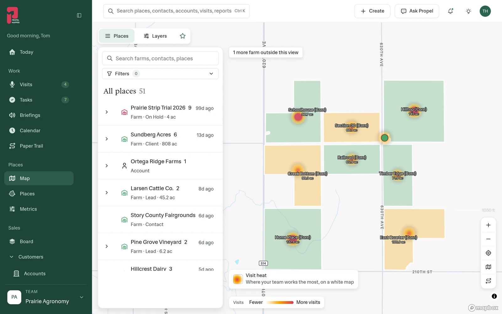
Example account: Prairie Agronomy
What each heat spot represents
Each spot is a capture: a voice note, photo, clip, typed note or reading, at the GPS point where it was taken. A visit with eight captures at one wet corner glows more than a visit with one note at the gate, which is usually what you want. The layer panel shows how many captures are in view.
It is a map of attention, not of problems. A bright patch might be a trial plot that gets measured weekly. Open the place to see why.
In the app
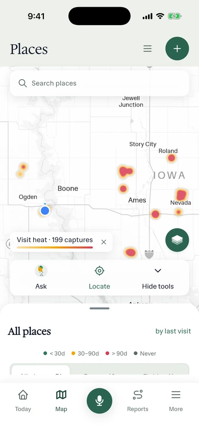
Example account: Prairie Agronomy
Questions about the visit density
Which places does the heat layer cover?
Every place the team has recorded a capture, drawn at the GPS point where it was taken. For the places that are due, use the Needs a visit list next to the last-visit color on each field.
Who it’s for
Managers of advisory and land management teams, and any consultant who wants to see their own season as a map before planning the next one.