
IntegrationsBoundary files
Import shapefile, KML and GeoJSON boundaries
PropelMapper imports field and site boundaries in the web app from a zipped shapefile, KML, KMZ, GeoJSON or CSV file, shows you a preview, and saves them as places you can visit.

A new client’s fields, before the first visit
A new client hands over their fields the way they have them: a zipped shapefile from the last advisor, a KML someone drew in Google Earth, or a GeoJSON export from another farm program. You don’t need to redraw any of it. In the web app, Places has an import that takes those files, up to 20 MB each.
Before anything is saved you see a preview of the shapes and their names. That is the moment to catch what comes with borrowed files: a field split in two, a lane drawn in, a boundary from three owners ago, or names that are only numbers. Fix the names now, and the phone, the map and every report will use them.
Once the fields are in, each place has its outline and area. On US ground the soil survey, crop history and NDVI layers clip to that outline, so the first visit starts on a field the client recognizes, with its context already loaded.
Boundary check: what you said and what the report says
“East field, first walk since we imported the client’s shapefile. The grassed waterway through the middle is inside the outline, so the mapped acres include it. Photo from the culvert. I’ll ask the owner if they want it split into two fields.”
Boundary check - East field
At a glance
The imported boundary for East field includes the grassed waterway through the middle, so its mapped acres include ground that is not cropped. A photo was taken from the culvert.
The owner will be asked whether to split the field in two at the waterway.
Observations
The imported boundary for East field includes the grassed waterway through the middle, so its mapped acres include ground that is not cropped. A photo was taken from the culvert.
The owner will be asked whether to split the field in two at the waterway.
After your review
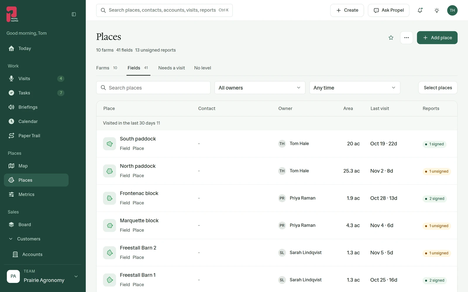
Example account: Prairie Agronomy
Getting the file ready
A shapefile is several files that only work together. Zip the .shp with its .shx, .dbf and .prj, and import the zip. The .prj says which coordinate system the points are in; without it, the shapes can land in the wrong place. KML, KMZ and GeoJSON import as they are, and a CSV is accepted for a list of places.
Keep the original file you were given. If someone questions an acreage in a report later, that file is what you compare against.
Checking what came in
Open the new places on satellite and look at the edges: the tree line, the waterway, the road. Mapped acres come from the outline you imported, and they may not match planted acres or the acres on a program record. If an outline is wrong, redraw it on the map or walk it with the phone instead.
What a boundary import does not bring
The import brings in outlines and names. Yield maps, as-applied files and prescriptions are not imported, and there is no live link to the program the file came from, so a boundary changed there later has to be imported again. If you need your boundaries back as a file, ask us.
Who it’s for
For advisors and farm managers taking on a client whose fields already exist as files, and for any team moving its places in from another program instead of drawing them again.